Otter Trail 2012: M*rt*n’s diary
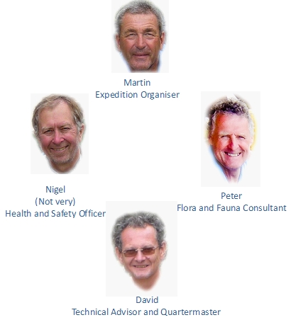
Having put up a few pics of the recent Otter trail, it’s time for a proper description of the trip. M*rt*n, who organized the whole thing has written a magnificent account of the trek, which I present here. My thanks to him for this great write-up and for arranging the whole expedition (plus 1200 kms driving!), and to P*t*r and N*g*l for being such amiable companions.
The ‘Not A Lot of Otters’ Trail… 7th to 11th February, 2012
 What is the Otter Trail, I hear you ask….?
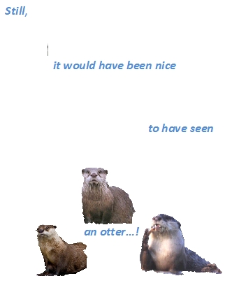
Probably the best known hiking trail in South Africa, it was opened in 1968. Heading westward from Storms River to the Groot River Estuary at Nature’s Valley the route runs along one of the most spectacular stretches of coastline in South Africa. It forms part of the Tsitsikamma National Park, a marine conservation area, in what is known as The Garden Route, which runs from George to Port Elizabeth, comprising craggy mountain ranges, huge lush forests, lagoons (‘vleis’), and stunning coastal scenery. It owes its name to the Cape clawless otter which inhabits the marshes and rivers along its coast, as well as the intertidal zone between land and sea. Some people who have hiked the Otter Trail have seen these shy, nocturnal creatures; most have not. Hence the title…!
Over the past few years I’ve met lots of people who have done the hike, some of them much younger than me, many much older. Every one of them just raved about it, but it didn’t get into my head until sometime early last year when David and I discussed the idea of doing it as a small tip of the hat to approaching our 7th decade (mine was approaching faster than his). Given its length (45km), its terrain (steep cliffs, winding paths through pristine forests, rocky and sandy beaches, and 11 river mouths to negotiate), it’s duration (5 days), and that you carry everything on your back, this is not an undertaking to be treated lightly. Obviously, as a natural athlete, I was undaunted by this but clearly had to pick my companions carefully. David and I each undertook to recruit one person.
So, I contacted SANParks (South African National Parks) in February last year to make a reservation for four people, and in time I received a notification of our dates, 7th to 11th February 2012. Gulp, now this was going to get real! I’d written to Nigel (former cricketing friend and wannabe rock star) to see if he’d be interested, and given that the dates allocated coincided with Alison’s half-term holiday (she is a teacher), he said, absolutely Yes! In the end David’s mate couldn’t make it, so Nigel invited a friend of his, Peter, who was game to do it and bring his wife, Nicola, for a holiday. Now we had our party of four: that we ended up with an aggregate age of 235 between us was down to chance, not intelligent design. Fortunately, despite our ages, we all were reasonably fit. David is a regular runner and has undertaken many Himalayan treks; Peter is a very regular walker and has also trekked in Chile; Nigel is a regular cricketer and sometime runner; and I go for occasional walks and since the previous December had been having a weekly session at the gym under the supervision of our friend Brenda.
Weight is everything in these circumstances, so finding lightweight rucksacks, sleeping bags, cooking equipment, etc. was important. David did most of the research for this and over the weeks that followed emails and conference calls were traded so that we were all able to be suitably equipped. Food was another important aspect, not only for its nutritional content but to also experience at least some pleasure in eating it. One evening David and I experimented with a packet of dried Chicken Marsala Curry (which turned out to be delicious!), crackers with flaked tuna and chilli sauce, porridge with granola, and noodles with a Tom Yum ‘oxo’ cube mixed in, fortunately accompanied by a good bottle of Sauvignon Blanc.
Fitness was by now also high on the priority list. Our trip to the UK and US had added several kilos to me, which I had shed by October, and I then started doing my local walks with about 25lbs (11+ kilos) on my back. For anyone who has not walked steep mountain paths, it’s the coming down that hurts most, so Brenda was making me do various exercises to strengthen my knees and quads. I know Nigel had started running regularly, as well as playing tennis, and (according to him) had cut out his midweek wine and beer. David always runs anyway, and was latterly flogging up Box Hill with a loaded rucksack. I don’t know what Peter’s preparations for walking were, but he was avidly taking swimming lessons in anticipation of the river crossings we had to make.
We set off from Noordhoek early on the Monday morning, each of us with a rucksack weighing around 15 or 16 kilos. It was going to take us about 7 hours to get to Storms River, about 650km away. It was a very hot day, with clear skies, the temperature hitting 38deg at one stage. The forecast for our week ahead on the trail was a bit disappointing: cloud and occasional rain, some heavy. However, after a stop-start journey with annoying road work interruptions we reached our destination, the Armagh Country Lodge, around 5:30pm, and went straight to the pool for a refreshing swim. The skies were still clear so maybe the forecast was wrong? Peter and Nicola were already there and that night we had a convivial dinner together before retiring for our last night in a real bed for a while.
Day One – Tuesday 7th February
This is it. Breakfast, then a final repacking. Actually the bags felt OK. That was until we added the firewood. We’d agreed to do the South African thing and take some steak to braai (BBQ) for the first night, which meant each of us carrying a couple of logs for the fire. Still, that would be gone by the next day. It was warm and a bit dull, but it didn’t look like rain. We drove to Storms River, checked in for the trail, and went down to the restaurant at the River Mouth Camp Site for lunch. Strictly TT this time.
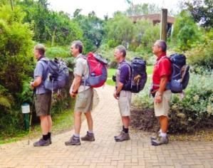 At 12:50 we said our goodbyes to Nicola (who was staying in the area for the next 5 days) and set off. We weren’t actually singing Boy Scout songs but we probably all felt like it. The first day is very gentle. Just less than 5km and an estimated time of a couple of hours, so there was no need to rush. Besides once you are at the campsite, you have a long evening ahead. The start of the trail descends along the edge of the coastal forest and comes out onto the shore where you clamber over a rocky beach until you arrive at Waterfall River.
A beautiful black and silver waterfall tumbles over the cliffs above into a tea-coloured natural pond, about the size of a tennis court. Now we wished we’d started earlier and brought our lunch here. Definitely time for our first swim. There had been some discussion about whether one should wear ‘normal’ swimming shorts (baggy, bulky, don’t dry so well, but look okay on any figure), or a variety of Speedos (dry well, compact, but can cause convulsions on first sight). The swimming was delightful. A couple of young lads were scrambling up the waterfall and jumping into the black depths. We just swam around taking it all in. it was also an opportunity for Peter to practice his new-found swimming skills. He looked a bit tentative to say the least, but he did leave the comfort of the rocky edge and swam from one side to the other of a small inlet; some of the time his head was actually above water. Time to dry off and leave. What a wonderful introduction to the delights of The Otter Trail!
 We donned the backpacks and set off for the second leg of this short day’s walk. A short, sharp climb through the indigenous forest, then a gentle descent into the valley where the Ngubu’s Huts, our overnight rest area, were situated by a rocky beach with fabulous, Disney-like rock pools inset from the water’s edge. We arrived there at about 3:30pm and decided to go for a swim in the crystal clear rock pools. The furthest one, nearest the sea edge, was very deep and pretty cold, but as they progressed in a chain inland they became progressively warmer. We leapt in like kids, a touch euphoric from having completed the first day, as easy as it was. Peter had another opportunity to practice his swimming skills, in the most benign conditions, and an hour later we maneuvered our way across the sharp rocks to the hut.
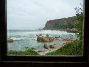 Time to unpack and get organised for the evening. Each hut we encountered on the trek was identical, there being two huts per rest stop. A fire pit below the stairs for cooking or having a camp fire to sit around, leading to a deck where you could sit out and chat, eat, or read. Then inside the hut were two stacks of three bunkbeds at right angles to each other, each with a fairly unyielding mattress. There wasn’t a whole lot of room for laying out personal possessions so one’s bed was really one’s only space. Half empty rucksacks took up most of the floor room. Once we’d got ourselves moderately organised it was about time to light the fire on which to cook our steaks. Tucked away behind the huts were two other buildings. One was the toilet: at every site they were clean, in perfect working order, and with a million dollar view!! There was also a covered communal cooking area, known as a lapa, with a braai pit, benches and a washing up sink. We decided to take our food and drink supplies there. Meanwhile our roommates, Kevin and Jill, from Southampton, had their meal in the hut. .
Peter and I struggled at first to get the fire started but perseverance won the day and a good base was gradually being established. During this process one of the guys from the other hut wandered down, whisky in hand, to say hello. He introduced himself as Tim, said he was 66 years old and had done the trail over 15 times. Turns out he was an ex-paratrooper in the South African army and had (as many of his generation have done) fought in the Angolan war. He was accompanied on the trail by his daughter Jeanette, a Captain in the army, and her husband Deon, a Major, and two friends. We had a very friendly chat, and he left to leave us to our culinary challenge, but not before he told us that poor Deon – all 6’6” and 250lbs of him – was carrying about 30 kilos in his pack as they all ate a lot of food!. Thankfully our steak turned out perfectly, as did the couscous (of which more, and more, and more, later), washed down by a cheeky little red. Around 7:30, as the night was drawing in, we headed back to the hut for a nightcap, supped a scotch and chatted before resigning ourselves to a long night.
Some people can sleep in sleeping bags. I cannot. Knowing this, I tried to read for as long as I decently could, with my camper’s headlamp (a must-have piece of kit, along with one’s Kindle!), but around 9 o‘clock settled down to sleep. Or not. At midnight I thought it was 3:00am, and spent the next few hours waiting for sunrise. Mercifully daybreak eventually came and I was able to get up. Dawn had been clear and starry but the clouds began to form as we prepared for the day.
Day Two -Wednesday 8th February
Our first breakfast, and I discovered I’d left my allocation of oatmeal behind! Luckily Patty had provided us all with some of her homemade granola, so we made do. Repacking the rucksack was a continual challenge, and David and Peter’s experience of long treks was clearly an advantage. Nigel and I managed to pack the things we most needed in the most inaccessible places. We set off just before 8:00am, just as a slight drizzle, or even a sea fret, was falling.
Tim had warned us that Day Two was a bit tougher, and indeed the route began with a thigh-burningly steep 100m ascent through the woods. Overcast though it was, it was warm enough not to need any rain wear, and visibility was pretty good. The woods were constantly ringing with a variety of birdcalls, and as we stopped to look and listen, the unmistakable honking, barking sound of a Knysna Lourie (Turaco) was above us, quickly followed by the flash of red from its wings. We were lucky to see this shy bird, especially in such a thick forest canopy. The dense treetop cover meant that throughout the entire walk, we heard far more birdlife then we saw (although Peter, a keen ornithologist and a permanent wearer of binoculars, may disagree!). Nigel’s eyes were firmly planted on the ground however, and, with the knowledge that at least three varieties of deadly snakes were almost always within a few yards of us, had his mind focused on other things!
 We emerged from the forest high on the coastline, and took a small detour to sightsee from an isolated rocky pinnacle called Skilderkrans, from which the views up and down the coast were spectacular. The rock was also quite slippery and it was a long and terminal way down! Then back into the woods, and eventually, pretty much at the halfway point of the day’s hike, we emerged at the Kleinbos River, one of the most scenic river mouth crossings.
All our ‘river thoughts’ had been focussed on the notorious Bloukrans (of which more later), so it was a bit 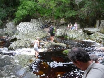 of a surprise to see that this crossing was actually a slight challenge! Although not wide, the water was fast flowing over rocks, and, as all the rivers were to be, tea coloured and thus difficult to gauge the depth. We had arrived there just as the other party were about to cross (our UK companions had set off earlier and were smugly ensconced on the opposite bank), and we watched Deon balancing barefoot on the rocks, carrying the rucksacks across one by one, making it look pretty easy. We took off our boots and socks, and took our turn to teeter over the rocks, desperately hoping not to be the pratt to fall in. Deon was a star: he stood on a rock and helped each of us across, slightly to our embarrassment. Once over, we realised that to our left, upstream, the river carved its way through a deep and dark ravine. This was too good to resist so we changed into our swimming gear and negotiated our way upstream to where the river formed a deep, dark, long pool from where one could swim 60 or 70m up to a waterfall. This was another good opportunity for Peter, as the water was deep but still. We spent half an hour or so there, and left not entirely convinced that Peter’s swimming skills would pass the ultimate test, but impressed by his determination. Unfortunately we have no photographs of this beautiful spot as we didn’t dare carry the cameras along the slippery river edge.
Incidentally, this was also the first escape point. There are six or so escape routes along the trail, used to evacuate injured hikers, or allow safe exit should the rivers be too dangerous or weather conditions make the trail unsafe. “My feet hurt” or “I want to go home” are not regarded as legitimate reasons to use the escape routes.
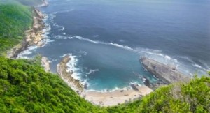 About another kilometre on, we came to a path that led down to a rocky beach. We were looking for Blou Baai (Blue Bay), as Tim had said it was a beautiful place to have lunch and swim. This didn’t look very ‘blue’ but we decided to have lunch there anyway. Crackers were the lunch medium of choice for the entire trip, eaten with a variety of cold meats, piri-piri Chicken spread, or flaked tuna. It may not sound very appealing to you, but believe me, it was to us! We had a very steep climb out of the cove and when we emerged from the woods at the top of the trail, we found a viewing platform, way below which was… Blou Baai of course. We’d missed the path. It looked stunningly beautiful, a perfect sandy beach surrounded by a horseshoe of rocks, bordered by the forest behind. However, none of us could face the prospect of that steep climb again, so we moved on. We stayed high on the plateau, and then the path made its way down to the next camp, Scott’s Huts, nestling on the banks of the Geelhout River.
 It was only about 2:30pm, so once we’d taken off our packs, swimming in the rocky bay seemed a good option. I went off down the right hand side of the bay, as the water looked deep enough to swim in. I found a little inlet and entered the water. It was freezing! Our previous swimming experiences had been in the rivers, and in rock pools. I was surprised how cold the open sea was. Meanwhile David had gone down the other side of the bay, and judging by his colourful language, had the same reaction. I thought about swimming the 40 or so metres over to him and then quickly decided enough was enough! The rest of the afternoon was spent washing selves and bits of clothing, and a bit of reading… and a nice cup of tea!
From the dizzy heights of fillet steak the previous night we fell to our freeze dried concoctions, but how bad does this sound for an evening meal: a ‘sundowner’, chicken sate, vegetable tikka rice, a glass of red wine, and a nightcap? After eating we wandered down to the water’s edge and could clearly hear the mewing sound of otters. This would be their typical environment: low tide, rocky beach, darkness. Unfortunately the beams from our headlamps weren’t strong enough to pick them out, so they remained frustratingly invisible to us. Oh Lord, its 9 o’clock….time for bed!
Day Three – Thursday 9th February
Up at 4:00am. It was a beautiful, warm starry morning. The Southern Cross was magnificent sitting above the ocean, a full moon was shining on the bay in front of me, and it felt as if it was going to be a lovely day. After all the usual morning routines we set off from the hut at around 8:00am.
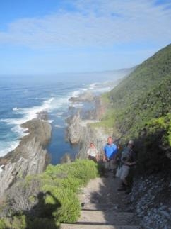
Wow, already Day Three! This was to be the most spectacular day’s walking of the trip, partly because the weather was so perfect. At first a short climb through the woods – every day began this way as the huts were always located at a river mouth, and thus the next day’s climb had to start with an ‘up’! Still, a good way to get the blood circulating. As we emerged from the woods we were rewarded by the sight of a beautiful coastal path along the edge of the shore. This was delightful walking, easy and spectacular. We made good progress, and within an hour reached our first river crossing of the day, the Elandsbos. We were fortunate to have arrived almost at low tide, having given no though to this at all.
We emerged from the forest to see a huge sandy beach with a placid brown river meandering through it.
While this was not in itself a ‘Speedo’ moment, the water was deep enough for us to need to take of our shoes and socks. Tim, Deon, etc. had arrived just before us and were settling down for their breakfast/mornin g tea or whatever. It was such a beautiful tranquil spot we decided to do the same, and spent an hour relaxing, walking on the sands and swimming in the river, which in places had formed a lagoon with steep banks and about shoulder deep. This was a perfect place for Peter’s final practice before the Big One tomorrow! Because it was safe, Peter was visibly more relaxed swimming and for the first time we felt mildly comfortable that, in all but very poor conditions, he would get across the Bloukrans, even if some help was needed.
After this delightful interlude, we carried on our way, with a short climb out of the estuary and more eye-popping coastal scenery.Mini Scottish-style sea lochs were cut into the rocky shoreline, black jagged rocks that would slice open anything that struck them. Gulls, terns, oystercatchers, and cormorants were our companions all the way.
We knew we were approaching the last big climb before reaching the Lottering River and our huts, so rather than stopping for lunch, we pushed on up the steep path in what was by now quite hot sun. And then suddenly below us was the Lottering. Again, we’d paid no attention to this in our planning and from where we were some 100m up, it looked a bit serious. 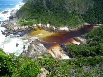 A broad river mouth, maybe 50m across, with foaming, swirling water. As we descended, the trail began to cut back up-river and when we came out at ground level all we were faced with was a bit of rock-hopping over about 20m of burbling water.
A wet boot would be the worst thing that could happen and we all made it across bone dry. Then a short walk up and around the far bank, and there were our huts (Oakhurst), beautifully positioned at the edge of the river mouth with spectacular rock formations all around us. Wow, what a campsite! By now the tide was coming in and the river mouth took on a new, more sinister dimension as the waves pounded around us and met the downward flow of the Lottering River from the hills and mountains above. The noise was spectacular.
It was time for lunch, and I also remember drinking lots and lots of water. The walking had been hotter and more demanding than I had realised. Although it had by now clouded over a bit, it was still a lovely afternoon, and good for drying out some still damp clothes from the previous day’s wash.
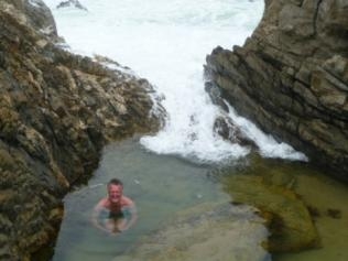 Over to our right was a little valley of rock formations where successive parties of hikers had built quite intricate stone formations on the bigger rocks. Behind these were some lovely rock pools, which looked ideal for a dip, as the sea and the river estuary were by now too rough. One pool in particular looked really inviting, as it was deep enough to sit in and be almost fully immersed, but had a sort of chair in the middle just below the surface. The water was continually refreshed by the incoming tide, which also meant the temperature was, er… refreshing, especially when a wave broke and sprayed anyone on the seaward side of the pool. The little crabs and sand fish seemed to be enjoying it as much as we were.
This was a very beautiful place in which to while away a few hours. In front of us and to either side was a 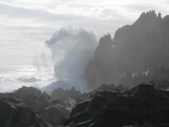 view that cannot have changed in millennia. Waves crashing – by now really crashing – on jagged rock formations, sending spray 50-60 feet in the air. Large pieces of rock that had very obviously been snapped off what had once been pillars of rock, lying patiently where they had fallen. Amongst all this prehistoric scenery it seemed strange to be reading from such a symbol of the 21st century, my Kindle!
There was firewood available under the hut, so we decided to make use of the fire pit outside the hut to build a fire for the evening, just for the atmosphere of it. We gathered as much brushwood as we could, and anything else that looked remotely combustible, and managed to build up enough of a heart for the bigger pieces of wood to catch. Half an hour later we had a real fire going. As we sipped our sundowners and debated over which culinary delight we’d each tuck into tonight, Tim and Deon came over for a chat.
The main topic for discussion was what time to set off in the morning, as the next day’s hike was dominated by the need to cross the Bloukrans River at low tide, which was scheduled for 11:33am. The books will tell you it takes about 4 ½ hours to do the 10kms from the huts to the river, but Tim was taking a conservative line and said they were going to leave at 5am. And the forecast was poor. Who were we to disagree with a man who’d done this some 15 times before? That meant we all had to be as packed as possible before going to bed. The Bloukrans had other implications too, as crossing a big river demands one protects one’s rucksack by stuffing it into a large plastic ‘survival’ bag, which keeps everything dry, as well as providing a welcome flotation aid. David had meticulously worked out the definitive way of tying off the bag and leaving some rope for hauling it, so we spent 10 minutes having a Masterclass on how to do this!
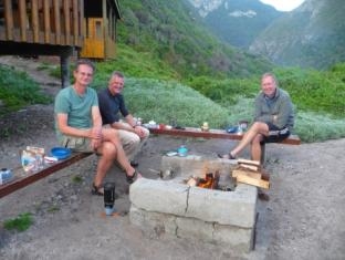 The night’s meal was memorable mainly for the sheer volume of couscous on display. Nigel, having knocked over his first choice of meal, opted for the Chicken Tagine, which, when supplemented by the extra couscous we were all sharing, pretty much destroyed everyone’s appetite for this particular form of starch for some time to come. Even when embellished with lashings of chilli sauce, it is still only couscous. The evening was rounded off sitting by the fire supping a nightcap. By now the clouds had completely dispersed and it was a beautiful starry night.
Day Four – Friday 10th February
Awake at midnight, awake at 2am, and up at 4am… I’m really not enjoying these nights! However it’s a gorgeous morning, with a sky full of stars, slightly diminished by the brightness and size of the moon. This is a good thing: a full moon and a low tide are a great combination (we think), and maybe the Bloukrans won’t be as daunting as we fear? The problem is not knowing what volume of water is rushing downstream from the mountains. The Kleinbos was pretty active, the Elandsbos and Lottering only moderately so. We’d soon find out.
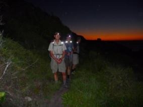 It was still dark when we left at just before 5am, so we all had our lamps strapped to our foreheads. It was a slightly surreal sight: a procession of semi-awake hikers marching silently through the forests, each with one bright eye. The first little section out from the camp was quite steep, but thereafter the terrain was fairly undemanding. Dawn was breaking behind us, the black night sky now seeping red on the horizon, and it wasn’t long before the headlamps were unnecessary. We were making good progress, and after an hour had covered 3km, and as we’d arrived at a pleasant little rocky cove we decided to break for a welcome coffee. We continued on our undulating way, alternating between coastline and indigenous forest. By now the clear skies of early dawn had turned heavy and grey, and a steady drizzle was falling. It was tolerable at first but then it became necessary to put the rainproof covers on the backpacks and don a rain jacket.
After another short break, we swapped walking partners, David going on ahead with Peter, Nigel and I following on behind. The walking was not difficult, but the persistent rain was making some of the paths and rocks a bit slippery. Nigel had pulled on the hood of his rain jacket, and eyes focussed on the ground he suddenly yelped as his head struck a low hanging branch he hadn’t seen. This caused him to ricochet on to me, which in turn sent me sliding down a steep bank. Instinctively I grabbed the nearest thing to me, which was Nigel’s sore shoulder. This completely pole-axed him, and his choice of language was, shall we say, colourful. Meanwhile I had managed to jam my left boot into the slope below me to halt my fall, and my right knee was now jammed into Nigel’s back to stop him following me down the slope. Which is how Peter and David found us when they turned back after hearing Nigel’s expletive laden screams. (Looking back, this now seems hilarious, but it wasn’t at the time. It didn’t seem appropriate to take any photographs!) A few minutes later everyone’s composure was recovered and we carried on, none the worse. Nigel did, however, make sure his hood was no longer over his eyes.
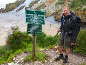 Up one more steep rise and then below was a stunning view of the infamous Bloukrans River, with a very obvious sign urging you take the escape route if conditions were not to your liking, such as rough seas, high tides, or darkness. It didn’t actually say “or if you can’t swim”, but it was sort of implied, as anyone looking at the 50m wide river mouth and the inaccessible cliff on the other side would have to realise that this could be quite a serious undertaking. Which is why you are urged to consult the tide tables before you start your hike because arriving at low tide is an imperative. Given that you are advised to allow 4 ½ hours to cover the distance to the crossing, and you have a further 2 hours to walk afterwards before reaching the next huts, you can imagine what it would mean to find that low tide is at 5am. Some people are unlucky and just have to take the tortuous escape route.
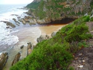 We, however, being a party of racing snakes, reached the top of the cliff soon just before 9am, and followed the steep path down to the river mouth. We could clearly see Deon crossing… and the water, still not at low tide, was only up to the top of his thighs! The mighty Bloukrans was not so mighty today! I suspect Peter let out a huge, if private, sigh of relief! We saw Deon go back and take both his wife’s and Tim’s bags across – this guy was a man-mountain – at which point from the path, and some 75m away, I heard him yell “Oh ***k, there’s a shark!”, his arms outstretched to show its approximate length. Luckily Nigel didn’t hear this observation of the wonders of the ocean, and we proceeded to where David and Peter were now preparing to cross.
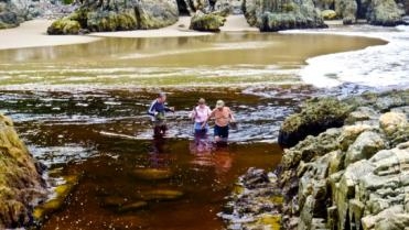 Rightly or wrongly I had decided that if it was a nasty shark it would prefer a meal the size of Deon, or else it was a sand shark, which I reckoned was no big deal. Deon, safe and well, and now on our side of the river, offered to carry our packs across, but this was too much. There was no river to speak of and now Superman is looking pityingly at this bunch of old men and offering to carry our stuff? No way! We’d prepared ourselves for a river crossing and that’s what we’d bloody well do. Off with shoes and socks, on with speedos, rucksacks securely in their waterproof bags, tied off as per David’s instructions… off we marched. I was very happy to get into the rust coloured river water and get wet up to my waist (I found a deep bit!), and drag my pack behind me. There were some hidden rocks to negotiate but in a few brief seconds the whole exercise was over. I had been carrying 500g of rope (that’s a wine box!) specifically to assist Peter if he got into trouble, and he barely had the decency to get his shorts wet. So much for the Bloukrans. “That’s the lowest I’ve seen it in 20 years”, said Tim. I think we all wished it could have been just a little more dramatic after all the preparations we’d made! We recognised we’d been very lucky meeting Tim and Deon, being able to benefit from their previous experiences, and it was great to know that had we had problems Deon was just the kind of guy to have around you.
It was now time to relax for a while on a pleasant spit of sand, watch the river shrink further, and have 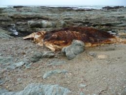 breakfast. We had only about 4km to go now, and it was only about 10:15am, so there was absolutely no hurry, other than the weather closing in again. The start of the final leg of the trail involved some fairly intricate scrambling up the cliff assisted by fixed chains, then a coast-hugging trail, which took us past a distinctly dead and smelly whale carcass. We’d seen this on a couple of You Tube clips, and reckoned it had been there for 4- 5 months, which would be exactly during the whale migration season in July to November. This was followed by a steep 100m ascent, a walk along the plateau with superb views, and then a steep descent to the final camp, the Andre Huts, nestling beside the Klip River, where a bonus was awaiting us. In the previous campsite there was a phone number to call if you wanted beers delivered to the Andre Hut. If? If? What’s there to ‘If’ about? So on arrival we had our usual lunch accompanied by a cold beer, keeping another bottle for later. It went down well.
In better weather this would have been a lovely place for a swim, but It was by now pretty miserable and 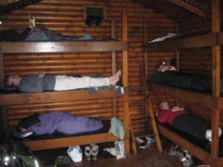 after such an early start, everyone was pretty quiet (except, initially Nigel, who must have had a sugar rush after lunch, or maybe it was the effects of near concussion). I went for a shower: an outside shower, in the rain, cold water only. Still, it felt good a few minutes later. Overall it was a quiet end to a big day, and the evening followed its usual pattern as we ate and supped the last of our wine and grog. After four days completely away from civilisation, it was strange to see the lights of Plettenberg Bay flickering on the darkening horizon – a definite reminder that the journey was coming to an end.
Day Five – February 11th
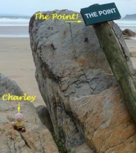
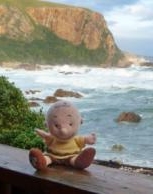 For those of you still alert, you will have deduced that this is now the last day, so please pay attention until the end. You’ve made it this far, it would be a shame to quit now. Besides I haven’t introduced Charley Brown. Patty’s Dad was called Charley Brown, and although he’s no longer with us, he often accompanies us on trips such as this. He loved nature, and music, and I offered to give him a ride on the trail (having weighed him first of course). He was no trouble, and seemed to enjoy it. Very quietly. He appears in quite a few photographs.
The morning breakfast and packing procedures took their place, and after some debate about when to go, as in “What’s the rush, we’ve only got 7km to go?” we set off just after 8am. One good reason to go was the hut smelt very fruity: we all clearly needed soap and water. The weather was good, but clouds were building to the south and west. Ironically we were delayed by the Klip River as it made its rocky way down to the sea. It was just deep enough to give one’s feet a good soaking, which is not a good way to start the day. After watching Tim’s party ahead negotiate it (which unfortunately was the last we saw of them) we chose our stepping stones. With consummate timing I chose a wrong stone and ended up on my rear end in a nice cool pool, thus achieving everything I had spent the last fifteen minutes planning to avoid.
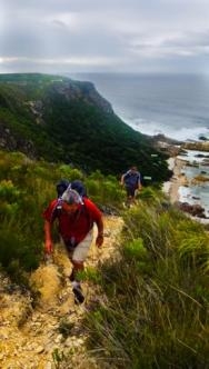 The last day starts with a pretty aerobic climb out of the valley, probably the steepest we’d had on the trip, if not the highest. Once on the escarpment the views of the huts below, the Klip River estuary, and down the coastline were fabulous. The trail stays pretty much on the plateau, and is an easy ramble along the clifftops, with the exception of a gentle descent and ascent at the delightfully named Helpmekarkloof. This is quite different terrain to the forest vegetation and coastal paths we’ve been used to. To the right is waist high fynbos, with concentrated masses of Blue Sugarbush, Pincushion Protea, Cape Everlastings, and Erica, all providing home and sustenance to colourful birds such as the Orange-breasted Sunbird and the Sugar Birds which we hadn’t seen before on the trail. To the left is infinity. In some places there is literally three feet or less of scrub to the side of the path and then a drop of 100m down the sheer cliffs to the sea and rocks below. Indeed in some places the path itself was running over an undercut piece of cliff face. This would be dangerous in a strong wind. Patty had been right to insist that I get my Will done before the trek!
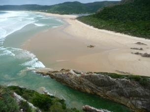 As it was, the day had turned out to be perfect for walking. Alternately light cloud and blue skies, with a lovely sea breeze blowing in our faces. Putting aside the perpendicular precipices to our left, the ocean views were spectacular and the last few easy kilometres went by in a happy haze. Too soon, we were looking down on the Groot River Estuary, across which were the lovely beaches of Nature’s Valley, and the end of the trail.
David and I were the advance party on this occasion and we headed down the steep trail, our final descent, and waited for Nigel and David at a place aptly named The Point.
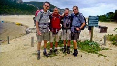 The four of us made our way across the golden sands, where crossing the lazy dribble of the Groot River posed no challenges. We aimed towards the car park by the lagoon, where Nicola was waiting for us – well for Peter, really. Poor girl had to brave hugs from four distinctly odiferous unshaven men. There was one more thing to do, and that was to find the pub that Tim had told us about, a traditional way to end the trip. It was allegedly called The Vasselot, a further 2km up the road, so ignoring Nicola’s offer to give us a lift, or even take our bags (which by now probably weighed about 75% of their original weight), we set forth, confidently ignoring signs saying ”Pub this way” on our left. “Probably there to divert you from the real pub” said Peter with great reasoning. We eventually saw signs to “The Vasselot”, which on arrival turned out to be nothing more than a camp site. In despair at such disinformation we now accepted the offer of a lift and eventually found the pub by following the signs we had haughtily ignored 20 minutes earlier.
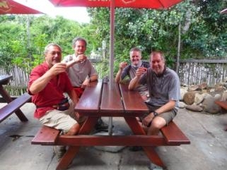 As well as a round of beers, we also ordered a round of what they called The Otter’s Arsehole (sorry to offend anyone but that is what they are called), which was a shot of a various mix of toxic liquids, to be consumed in one hit. Actually they were very tasty. These were accompanied by certificates of achievement.
And that was that! So, back to The Point…what was the point? That was my first trek, and I know it couldn’t be classified as ‘tough”, even though it would be if one was unfit, or suffered some misfortune on the trail. I also know that there is other beautiful scenery in the world, some of which I’ve been fortunate to see, much of it I haven’t and probably won’t. But as a combination of reasonably strenuous exercise, a few adrenaline-pumping challenges, an exquisitely beautiful environment, and the company of similarly minded friends, it’s got to be up there with the best, and I’m sure we are all delighted to have done it!
(The author wishes to thank P*tty for her editing and production work!)
